Mount LeConte: Trails, Tips, and What to Expect

August 5, 2025

Why Mount LeConte Stands Out

Mount LeConte is one of the most celebrated hikes in the Great Smoky Mountains National Park. Reaching 6,593 feet, it is the third-highest peak in the park, surpassed only by Clingmans Dome (formerly Kuwohi) at 6,643 ft and Mount Guyot at 6,621 ft.  As the highest peak located entirely within Tennessee, it also boasts the greatest vertical relief east of the Rockies- rising over 5,300 feet from Gatlinburg’s valley floor.

What truly makes LeConte unique is that you can’t drive to the top, it’s accessible only via hiking trails, with no roads reaching the summit. This trail-only access creates a sense of adventure and authenticity: every step to the top must be earned.

There are five well-established trails that lead to the summit and LeConte Lodge, all ranging from 5.0 to around 9.1 miles one-way:

  • Alum Cave Trail

  • Rainbow Falls Trail

  • Trillium Gap Trail

  • Bullhead Trail

  • The Boulevard Trail (via the Appalachian Trail)

    • Along the way, hikers pass scenic landmarks such as the Alum Cave Bluffs, Grotto Falls, Myrtle Point, and Cliff Tops

  • At the summit plateau, visitors encounter LeConte Lodge, the only lodging inside the national park and the highest-elevation inn east of the Mississippi River, perched near 6,360–6,593 feet. The rustic cabins have no electricity or internet; instead, guests rely on kerosene lamps, propane heaters, and hearty meals—creating a distinctive trail‑in, disconnect-to-reconnect experience  Iconic views points including Cliff Tops and Myrtle Point offer breathtaking scenes: Myrtle Point is famed for sunrise views, and Cliff Tops is especially popular at sunset.

    Whether you’re aiming for summit views, a lodge stay, or just an immersive natural challenge, Mount LeConte delivers on all fronts. From its significant elevation to the inside‑the‑park lodge experience and panoramic overlooks, it is a symbol of the Smokies’ rugged beauty and a bucket‑list hike for visitors.

Where Is Mount LeConte Located?

Mount LeConte is located within Great Smoky Mountains National Park, just southeast of Gatlinburg, Tennessee. It sits in the central part of the park, between Newfound Gap Road (U.S. 441) and the Roaring Fork Motor Nature Trail, making it accessible from multiple directions depending on which trail you choose.

Closest Towns and Access Points

  • Gatlinburg, TN – About 10–15 miles from most LeConte trailheads

  • Newfound Gap – A high mountain pass on U.S. 441 that connects Gatlinburg, TN, to Cherokee, NC; also a starting point for The Boulevard Trail

  • Roaring Fork Motor Nature Trail – Access point for Rainbow Falls, Trillium Gap, and Bullhead trails

Although Mount LeConte is one of the tallest peaks in the park, there is no direct road leading to the summit, so hiking is the only way to reach it. The main trailheads are all accessible by car and are located along paved or well-maintained roads within the park.


Credit: PigeonForge.com
Trail NameTrailhead LocationDistance to Summit
Alum Cave TrailNewfound Gap Rd (U.S. 441), 8.7 miles south of Gatlinburg5.0 miles one way
The Boulevard TrailNewfound Gap parking area8.0 miles one way
Trillium Gap TrailRoaring Fork Motor Nature Trail8.9 miles one way
Rainbow Falls TrailCherokee Orchard Road near Gatlinburg6.5 miles one way
Bullhead TrailCherokee Orchard Rd (currently closed or limited access due to past fire damage)6.9 miles one way

Parking Info

  • Alum Cave Trailhead is located on Newfound Gap Road, about 8.7 miles south of Gatlinburg. The parking area is often full by 8 a.m. during peak seasons, so early arrival is highly recommended.

  • Rainbow Falls and Trillium Gap Trailheads are both accessed from Cherokee Orchard Road, a loop that begins near downtown Gatlinburg.

  • The Boulevard Trail begins from Newfound Gap, where there is a large, free parking area shared by Appalachian Trail hikers and sightseers.

  • Bullhead Trailhead has limited access depending on closures and is typically less crowded.

All parking for these trailheads is free, but as of 2023, the Great Smoky Mountains National Park requires a parking tag for any vehicle parked longer than 15 minutes inside the park. There are three types of tags:

  • Daily Pass: $5

  • Weekly Pass: $15

  • Annual Pass: $40

You can purchase these at visitor centers, self-serve kiosks, or online at recreation.gov.

No Park Entrance Fee

Unlike many U.S. national parks, Great Smoky Mountains National Park does not charge an entry fee. Visitors can enter freely from Tennessee or North Carolina. The only fee required is for parking, as noted above.

Mount LeConte Fast Facts

Mount LeConte is one of the most popular hiking destinations in the Smokies, known for its height, scenery, and unique summit experience. Whether you’re planning your first visit or just want a quick overview, here are the key facts you should know:

Elevation

  • 6,593 feet (2,010 meters) above sea level

  • It’s the third-highest peak in Great Smoky Mountains National Park, after Clingmans Dome (6,643 ft) and Mount Guyot (6,621 ft)

  • It is the highest peak fully located within Tennessee

Total Hiking Distance

  • Over 10 miles of maintained hiking trails lead to the summit

  • Hikers can choose from five main routes, ranging from 11 to 18 miles roundtrip, depending on the trail

LeConte Lodge

  • Located near the summit, LeConte Lodge is the only lodge inside the national park and the highest guest lodge in the eastern United States

  • There are no roads to the lodge — it’s accessible only by foot

  • The lodge consists of rustic cabins, propane heat, and communal meals

No Road Access

  • You cannot drive to Mount LeConte

  • All summit access is hiking only, making it one of the few major peaks in the U.S. where every visitor has to earn the view

Summit Experience

  • The actual high point is marked by a rock pile at High Top

  • Nearby scenic spots include:

    • Myrtle Point (best for sunrise)

    • Cliff Tops (best for sunset)

  • There’s also a shelter for backpackers near the lodge for Appalachian Trail hikers and backcountry campers

Weather & Conditions

  • Temperatures at the summit can be 10–20 degrees cooler than the base

  • Snow and ice are common in winter and early spring

  • Rain gear and layers are recommended year-round

Best Trails to Reach the Summit of Mount LeConte

Mount LeConte can be reached by five main trails, each offering a different hiking experience. All trails are one-way to the summit and require a return trip (unless you’re using a shuttle or doing a loop). Below is a breakdown of each route, including trail highlights, estimated time, and the type of hiker it’s best suited for.

This is not a self-guided attraction. All visitors enter the caverns in small groups with a trained guide who explains each section of the cave, from how it formed over thousands of years to how it was used by Native Americans and moonshiners. The lighting, audio effects, and setup are all designed to enhance the natural space without overdoing it. It feels immersive without being overwhelming.

Click here to learn more about Forbidden Caverns

Alum Cave Trail (most popular)

  • Round‑trip Distance: ~10.0 mi (16.1 km)
  • Estimated Time: 6–8 hours
  • Difficulty: Moderately Strenuous
  • Features: Arch Rock, Inspiration Point, Alum Cave Bluffs, scenic ridge and spruce‑fir forest

Best For: Most efficient route to LeConte Lodge; first-time hikers and scenic diversity

 Rainbow Falls Trail

  • Round‑trip Distance: ~13.0 mi (20.9 km)
  • Estimated Time: 7–9 hours
  • Difficulty: Strenuous
  • Features: Tennessee’s tallest single‑drop waterfall (80 ft), creek crossings, rocky forest, scenic overlooks like Rocky Spur

Best For: Waterfall lovers or hikers seeking varied terrain; cooler summer route

Trillium Gap Trail (llama supply route)

  • Round‑trip Distance: ~13.4 mi (21.6 km)
  • Estimated Time: 8–10 hours
  • Difficulty: Moderate to Strenuous
  • Features: Grotto Falls (Trail passes directly behind the waterfall), gradual elevation gain and forest transition at Trillium Gap, occasional llama resupply runs to LeConte Lodge

Best For: Hikers seeking a gradual ascent, fewer crowds, or a lodge overnight stay

 The Boulevard Trail

  • Round‑trip Distance: ~16.0 mi (25.7 km)

  • Estimated Time: 9–12 hours

Difficulty: Strenuous (elevation changes over multiple ridges)
Features: High-ridge Appalachian Trail access, views over Tennessee and North Carolina, spurs to Myrtle Point & High Top, varied subalpine flora
Best For: Experienced hikers and backpackers wanting high elevation views and solitude

 Bullhead Trail (least trafficked route)

  • Round‑trip Distance: ~13.6 mi (21.9 km)
  • Estimated Time: 8–10 hours
  • Difficulty: Strenuous
  • Features: Heath bald known as “Bullhead” with valley views, fewer hikers, rugged terrain due to past fire damage

Best For: Solitude and a different descent option, often used in loops with Rainbow Falls Trail

Summary Table

Trail

Round‑Trip

Time

Difficulty

Highlights

Alum Cave Trail

~10 mi

6–8 hrs

Moderate–Strenuous

Cave bluffs, Arch Rock, forest views

Rainbow Falls Trail

~13 mi

7–9 hrs

Strenuous

Waterfall, creek crossings, overlooks

Trillium Gap Trail

~13.4 mi

8–10 hrs

Moderate–Strenuous

Grotto Falls, llamas, forest diversity

The Boulevard Trail

~16 mi

9–12 hrs

Strenuous

Ridge views, AT access, alpine flora

Bullhead Trail

~13.6 mi

8–10 hrs

Strenuous

Solitude, valley vistas, rugged terrain

What’s at the Top of Mount LeConte?

Reaching the top of Mount LeConte is about more than just elevation—it’s a full experience. Unlike most summits that offer just a view and a signpost, the summit of Mount LeConte includes overnight lodging, scenic overlooks, and a strong hiking culture. Here’s what you’ll find once you reach the top:

LeConte Lodge

Mount LeConte is home to LeConte Lodge, the only lodging facility located inside Great Smoky Mountains National Park and the highest guest lodge in the eastern United States, sitting just below the summit at around 6,360 feet in elevation.

The lodge was founded in 1925 by Paul Adams as a simple tent camp and later became a rustic cabin settlement operated under concession by the National Park Service. Today, the lodge includes a series of hand-built cabins and a main dining hall.

  • No electricity or running water — light comes from kerosene or solar lamps, and heat is provided by propane heaters.

  • Meals are included for overnight guests (hearty, family-style dinners and breakfast).

  • Drinking water is filtered from a spring near the lodge.

  • Reservations are required, typically booked a year in advance via a lottery system.

  • The lodge operates from March through November and is only accessible by foot.

  • There is no cell service or Wi-Fi, which makes it an ideal place to disconnect.

Cliff Tops – Best Sunset View

Cliff Tops is one of the most popular side trails near the lodge, known for offering some of the best sunset views in the Smokies. It’s a 0.3-mile spur trail from the main LeConte Lodge area, marked and easy to follow.

From here, you get a clear view of the western horizon and surrounding peaks. On clear evenings, the sky lights up in deep orange and purple hues, making it a favorite for both overnight guests and day hikers who plan a late descent.

Tip: If you’re staying at the lodge, bring a flashlight or headlamp if you hike back after sunset.

Myrtle Point – Best Sunrise View

Located about 0.4 miles east of the lodge, Myrtle Point is the top spot for sunrise at Mount LeConte. The exposed rock outcrop faces the eastern sky, giving hikers an unobstructed view as the sun rises over the Smokies.

It’s slightly less visited than Cliff Tops, which makes for a quieter experience—especially at dawn.

  • The trail to Myrtle Point branches off from the Boulevard Trail, just before reaching the lodge area.

  • Many guests at LeConte Lodge wake up early and make the short hike with headlamps to catch the first light.

High Top – The Actual Summit

While Cliff Tops and Myrtle Point offer better views, High Top is the true geographic summit of Mount LeConte. It’s marked by a large cairn (rock pile) placed by hikers and sits in a dense spruce-fir forest near the LeConte backcountry shelter.

There are no panoramic views at High Top, but it’s a must-visit if you want to say you’ve stood at the very top. It’s about a 5-minute walk past the lodge on the Trillium Gap side.

Together, these three spots—Cliff Tops, Myrtle Point, and High Top—offer a well-rounded summit experience: panoramic views, peaceful sunrise spots, and a lodge stay that feels like stepping back in time. Whether you’re day hiking or staying overnight, reaching the top of Mount LeConte offers more than just elevation—it’s an experience you’ll remember.

When Is the Best Time to Hike Mount LeConte?

Spring (March–May)

  • Best for: Wildflowers, cooler temperatures, fewer crowds early in the season

  • Trail Conditions: Some snow or ice may linger at higher elevations into March and early April. By May, trails are generally clear.

  • Highlights: Spring wildflowers like trillium, bloodroot, and violets start blooming around late March and peak in April–May. Streams and waterfalls (especially along Rainbow Falls and Trillium Gap) are often full from spring rain and snowmelt.

Note: If you’re hiking in early spring, bring microspikes or traction devices—sections of Alum Cave Trail can remain icy through April.

Summer (June–August)

  • Best for: Long daylight hours, shaded hiking, lodge availability

  • Trail Conditions: Trails are fully open and generally dry by mid-June. Afternoon thunderstorms are common.

  • Highlights: Dense tree cover along most trails provides shade, making summer hikes more comfortable despite the heat at lower elevations. Temperatures at the summit are typically 10–20°F cooler than in Gatlinburg.

Tip: Start your hike early to avoid afternoon storms, especially if you’re taking longer routes like the Boulevard Trail.

Fall (September–Early November)

  • Best for: Fall foliage, crisp weather, fewer bugs

  • Trail Conditions: Dry, cool, and stable; some frost possible by mid to late October

  • Highlights: Vibrant foliage starts at high elevations in late September and moves down the mountains into October. Early mornings can be foggy, but midday views are often crystal clear. This is one of the busiest seasons, so trailheads fill up fast—especially Alum Cave.

Note: Nights at the summit can drop into the 30s by late fall, even if it’s warm in town.

Winter (Mid-November–February)

  • Best for: Solitude and snow-covered scenery (for experienced hikers only)

  • Trail Conditions: Ice, snow, wind, and low visibility are common above 5,000 ft. Some trails may be closed or inaccessible due to road closures (e.g., Roaring Fork and Clingmans Dome Road close seasonally).

  • Highlights: LeConte Lodge is closed during winter, but experienced hikers sometimes visit with proper winter gear. Views can be stunning if skies are clear and snow blankets the mountain.

Caution: Alum Cave Trail and Boulevard Trail are not recommended in icy conditions without specialized gear (like crampons and trekking poles). Temperatures can fall below freezing, and sudden weather shifts are common.

Tips for Hiking Mount LeConte

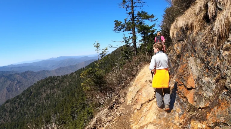
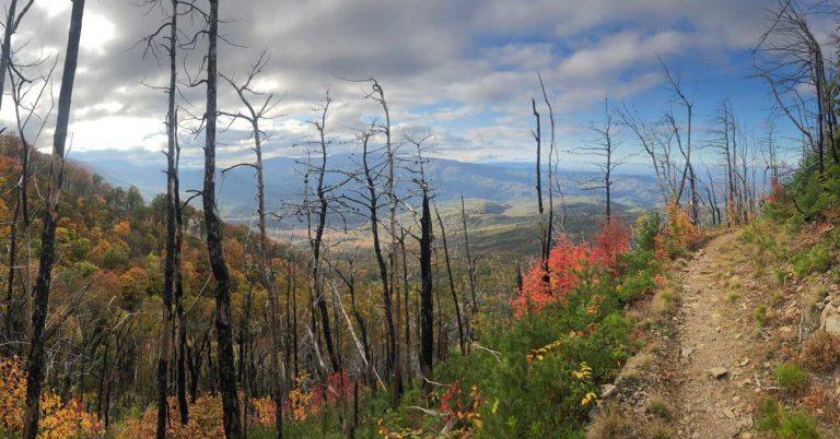
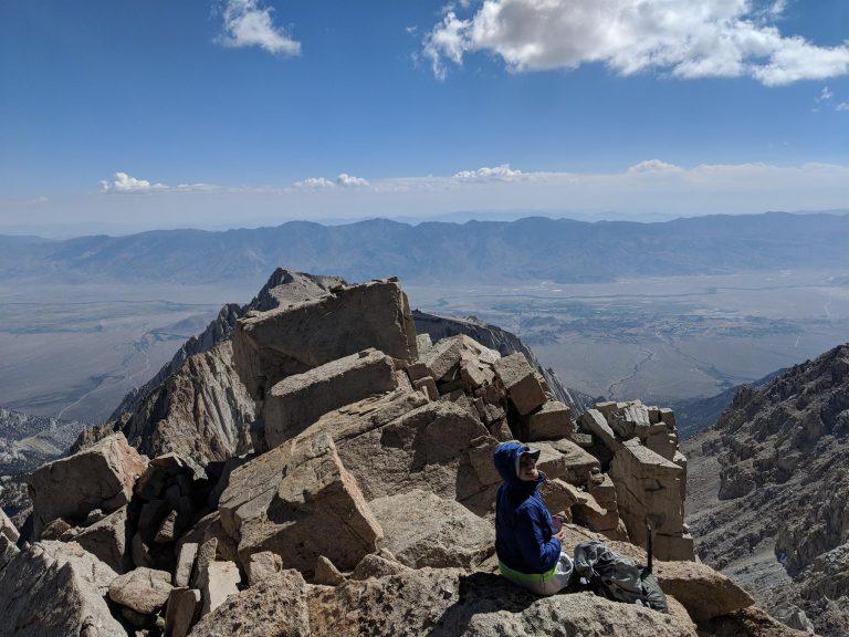
Hiking to the top of Mount LeConte is a full-day adventure, even for seasoned hikers. Whether you’re taking the popular Alum Cave Trail or a longer route like The Boulevard, proper planning makes the experience safer and more enjoyable. Here are key tips to keep in mind before you hit the trail:

1. Start Early

  • Most trails to Mount LeConte take 6 to 10+ hours roundtrip, so it’s best to start early in the morning, ideally by 7:00 or 8:00 a.m.

  • Parking lots—especially at Alum Cave—fill up fast.

  • An early start gives you more time to enjoy the summit and reduces the chance of getting caught in afternoon storms.

Great Smoky Mountains National Park – GringoPotpourri

2. Pack the Essentials

  • Water: At least 2–3 liters per person, especially in summer

  • Snacks or lunch: Bring high-energy items like trail mix, fruit, jerky, or protein bars

  • Rain jacket or poncho: Weather can change quickly, even on sunny days

  • Layers: Temperatures can drop by 15–20°F between the base and the summit

  • Headlamp or flashlight: Especially if there’s any chance you’ll be hiking back close to sunset

3. Bring Trekking Poles

  • Hiking poles help with stability on rocky or slippery sections, especially:

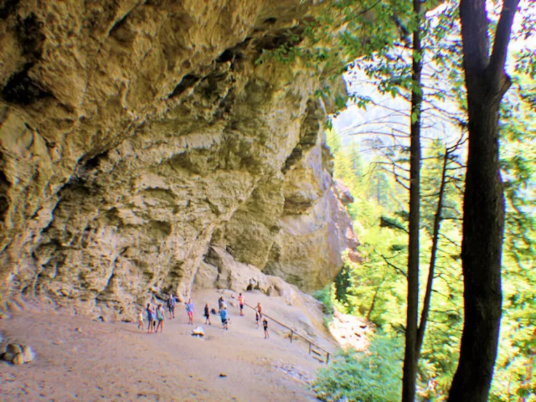
    • The steep switchbacks near the top of Alum Cave Trail

    • Descents on longer trails like Rainbow Falls or Trillium Gap

  • They also reduce knee strain and help with balance when carrying a backpack.

4. Cell Service Is Limited

  • Don’t rely on phone navigation or emergency calls during the hike.

  • Download trail maps ahead of time (from NPS, Gaia GPS, or AllTrails+)

  • Let someone know your route and expected return time before starting

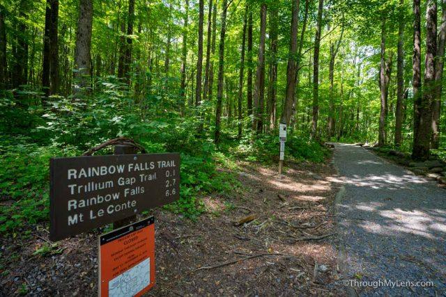
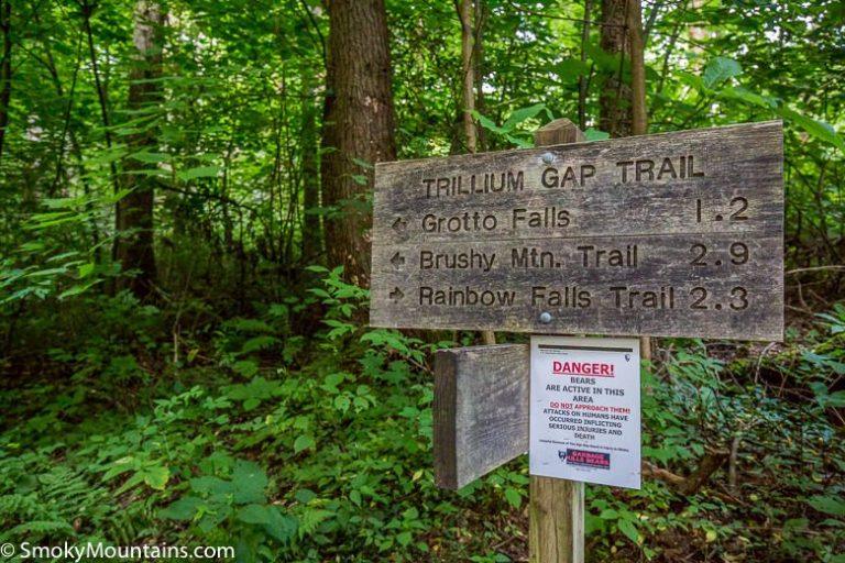
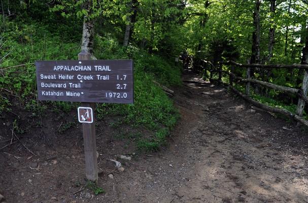
5. Trail Signs Are Present, But Basic

  • There are wooden signs at most trail junctions, but they may not list exact mileage or destinations like you’d see on urban trails.

  • Carry a physical map or downloaded GPX track to stay oriented, especially on longer trails like The Boulevard or Trillium Gap.

Bonus Tip: Know Your Turnaround Time

If you’re not staying at LeConte Lodge or the shelter overnight, be mindful of the time. Set a turnaround time—no later than 2:00 p.m.—to make sure you’re off the mountain before dark.

Proper preparation makes all the difference when tackling one of the Smokies’ most memorable hikes. Mount LeConte isn’t technically difficult, but the length, elevation gain, and unpredictable weather make it a true mountain experience.


How to Book a Night at LeConte Lodge

Amenities - Leconte Lodge

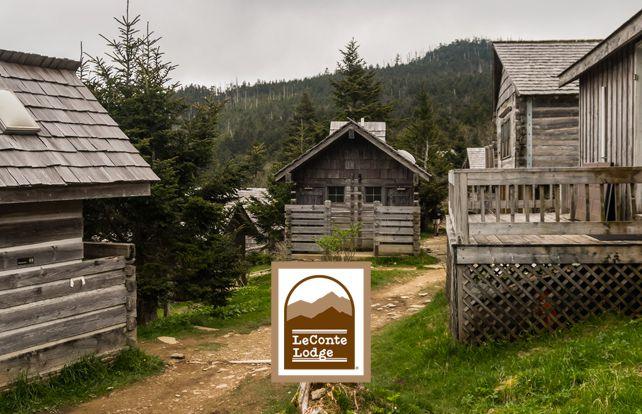
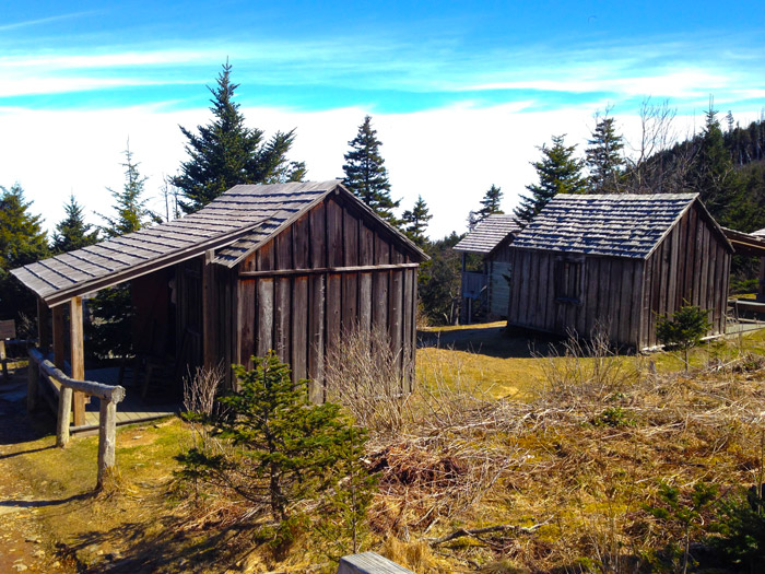
Staying overnight at LeConte Lodge is a unique experience—and the only way to spend the night at the summit of Mount LeConte without camping. But due to high demand and limited availability, reservations are handled differently than traditional bookings.

Reservation-Only, via Annual Lottery

  • LeConte Lodge does not use an online booking system. Instead, it operates through a lottery-based reservation request process.

  • Reservation requests are accepted by mail only, beginning October 1 each year for the following season.

  • Guests submit preferred dates, group sizes, and lodging preferences (single, double, or multi-person cabins).

  • Confirmations are sent out later in the fall or early winter, depending on availability.

Example: To stay at the lodge in the 2026 season, you would need to mail your request in October 2025.

Mt. Leconte Lodge | History and Hiking Trails Smoky Mountains

Season Dates

  • Open Season: Mid-March through mid-November (exact dates vary each year depending on trail conditions)

  • The lodge is closed during winter, as trails are often icy or snow-covered and not safely accessible.

LeConte Lodge overnight provides special hiking experience | Friends of the Smokies

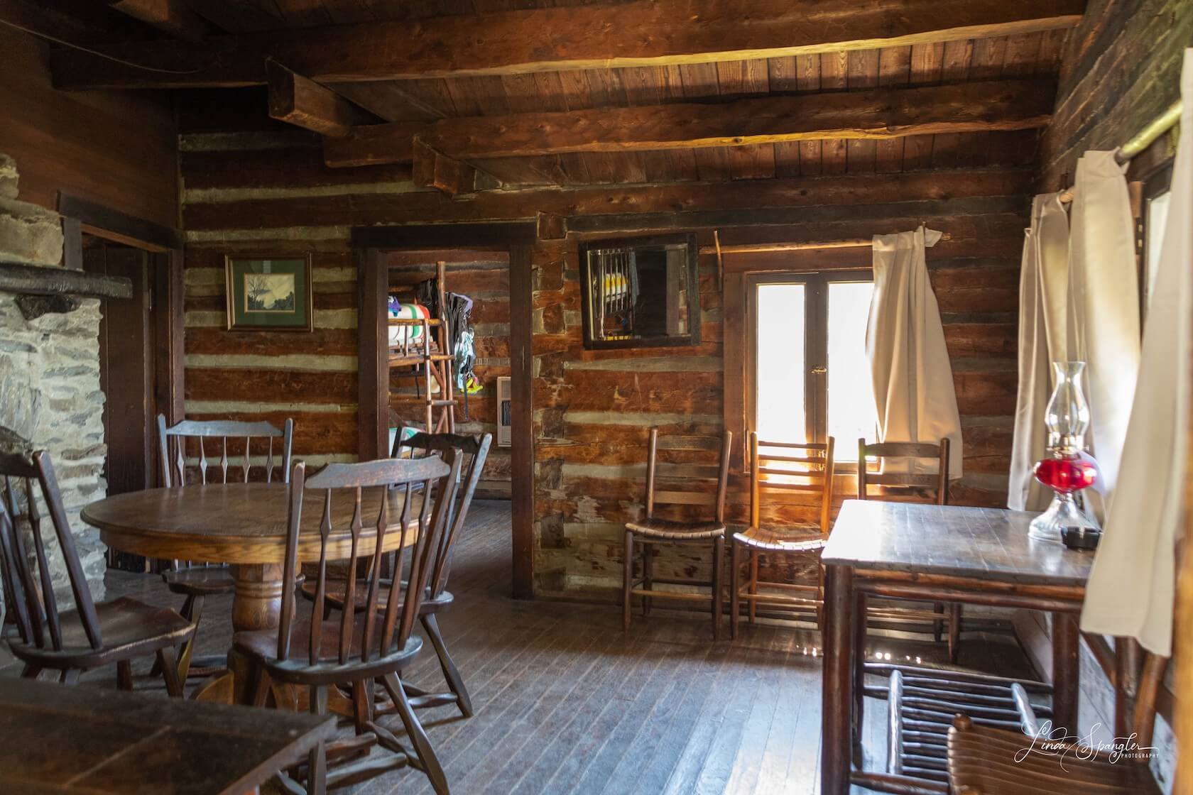
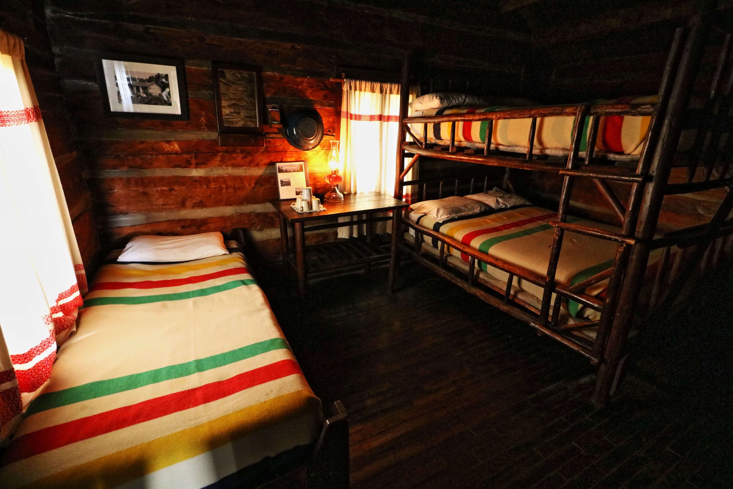
What’s Included in the Stay

  • Rustic log cabin accommodations (no electricity, no internet)

  • Propane heat, kerosene lanterns, and cold water

  • Hearty, family-style dinner and breakfast

  • Linens, pillows, and wool blankets are provided

There are no showers or indoor plumbing. Composting toilets are located near the cabins.

GREAT SMOKY MOUNTAINS | LeConte Lodge – little green field book

Mule and Llama Resupply

  • All food, propane, and linens are carried up by pack llamas or mules, since the lodge is only accessible by foot.

  • Llamas typically use the Trillium Gap Trail, and hikers can sometimes see them along the way.

  • These pack animals resupply the lodge three times per week, usually Monday, Wednesday, and Friday during the operating season.

Final Thoughts on Hiking Mount LeConte

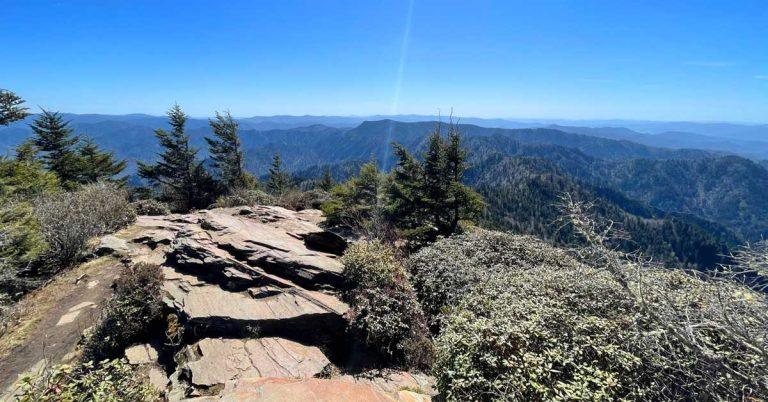
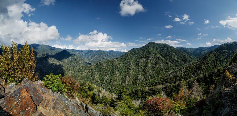
Mount LeConte is one of the most rewarding hikes in Great Smoky Mountains National Park—not just because of its elevation, but because of everything it offers along the way. Whether you’re chasing sunrise views at Myrtle Point, staying overnight at LeConte Lodge, or just looking to challenge yourself on a full-day hike, this mountain delivers a full experience.

With five trails to choose from, a historic lodge at the top, and sweeping views of the Smokies, LeConte is more than just a summit—it’s a destination. If you plan ahead, pack smart, and respect the conditions, hiking Mount LeConte can easily become the highlight of your trip to the Smokies.

Lodging in the Smokies

Hiking Mount LeConte for the day? Stay nearby in comfort and nature—without overspending.

If you’re planning to tackle Mount LeConte as a day hike, our tiny homes at Sojourn Lodging offer a convenient and relaxing place to recharge afterward. We’re located in Sevierville, just a short drive from key trailheads like Alum Cave and Trillium Gap, so you can hit the trail early and return to a clean, quiet space that feels tucked away—but still close to Gatlinburg and Pigeon Forge.

Our stays are designed to be simple but elevated – think private decks, cozy sleeping spaces, kitchenettes, Wi-Fi, and streaming-ready TVs. Every unit has been thoughtfully laid out to give guests space to relax, reset, and reconnect with nature or each other. Whether you’re here for a solo trip, a weekend getaway, or a group retreat, we have options that fit your plans.

We offer:

  • Pet-friendly units
  • Self check-in and private entry
  • On-site parking
  • Tiny homes for couples, families, and group bookings
  • Peaceful surroundings that still keep you close to all the action in Pigeon Forge and Gatlinburg

Want a closer look? Click here to explore our tiny homes or read more about what it’s like to stay at Sojourn.

After exploring the underground beauty of Forbidden Caverns, we’ll be here to welcome you back with a clean, quiet place to land.

Leave a Reply

Your email address will not be published. Required fields are marked *

Close
Sojourn Micro Lodging

1685 Newport Hwy,
Sevierville
TN 37876

Contact Info

© Copyright Sojourn Micro Lodging

Close